Van's homepage
A child exploring the world alone.
A neural network approach for climate classification - Sec 5. Historical climate change (1901-2020) based on the 322 scheme
by Van
In this section we are going to analyze the climate change on global land over 1901-2020 based on the climate features and the 322 scheme. Our analysis is always based on 30-year climate normals (hence the x-axis of the figures below start from 1930). The video below shows how the world climate map changes per decade. Full screen and 1080p display is recommended.
The video using the
533-5.2scheme (which is introduced in the next sections) is here.
Global
Climate features
First let’s take a look at the three principal climate features, since they are the basis of our climate scheme. The figure below shows the trends in the global mean of the three features over the years. The values are calculated on a 30-year rolling window which moves forward per year.
I also looked at the global variance of the three features, which almost remain constant.
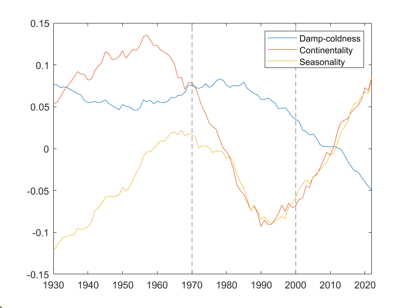
It can be seen that before mid-1980s the damp-coldness did not significantly go down. It was the fluctuations in continentality and seasonality that drove global climate change. The values first went up and then turned to a sharp dip down around 1960, continentality taking the lead and seasonality following with a brief lag. After reaching the lowest around 1990, the two entered a rising passage hand in hand. Also starting from this time, the damp-coldness shows an accelerating dropping trend.
If we have the data with longer history, we could see if the continentality and seasonality are intrinsically cyclical fluctuating or the trend is out of control.
How are the moves in climate features reflected in the change of climate types? We are going to explain it in three historical periods.
Climate groups
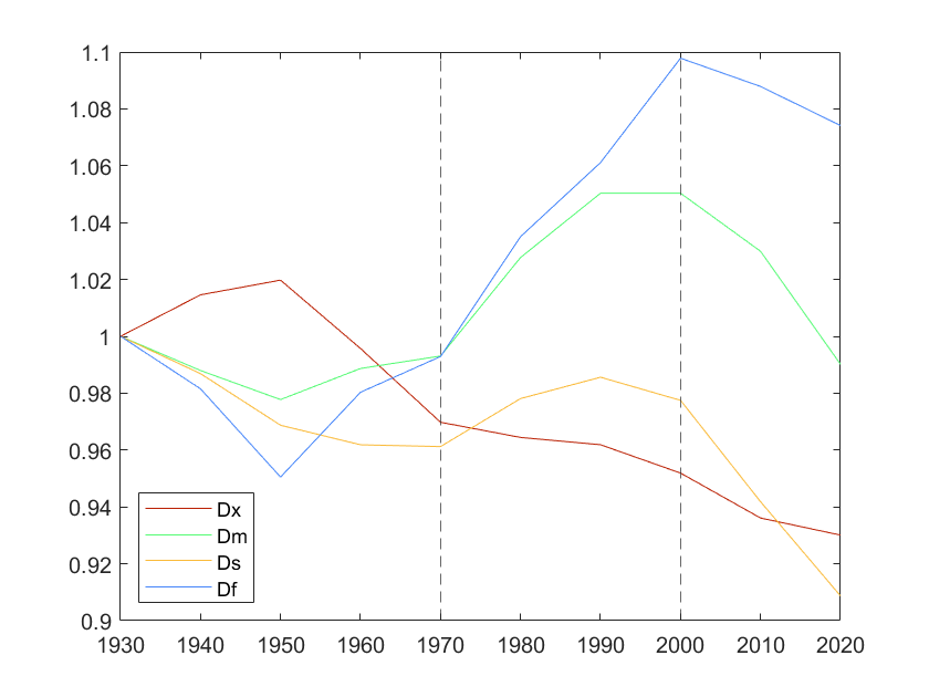
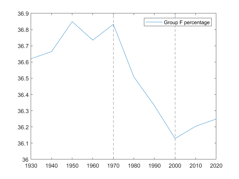
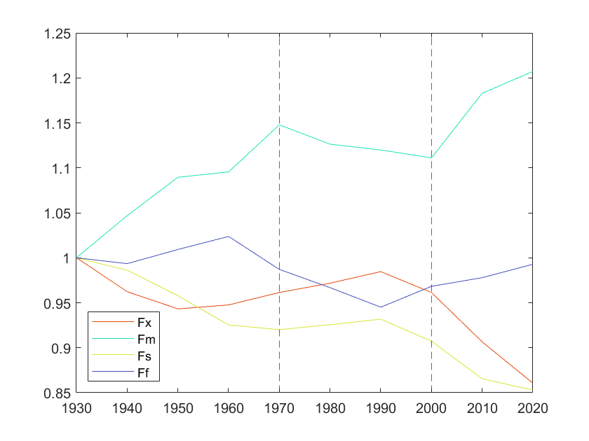
The above figures are based on values calculated on a 30-year rolling window which moves forward per decade.
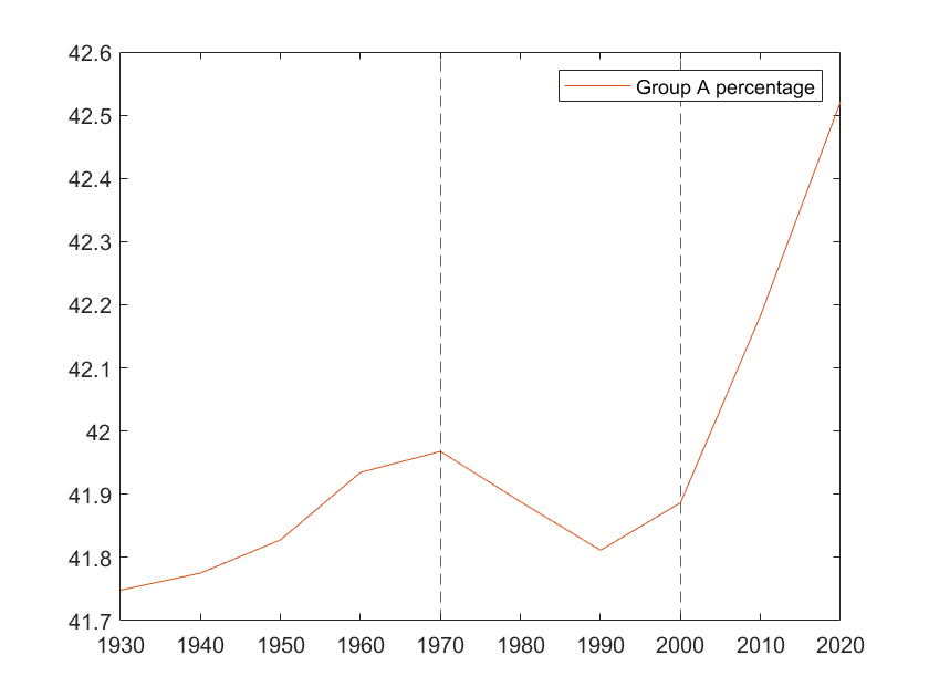
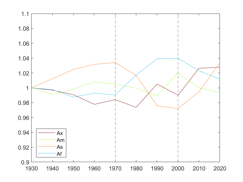
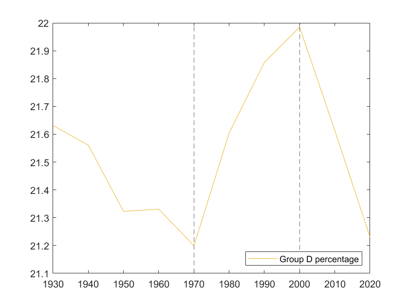
Within each main group the figures show the percentage change of the types. Note that the intrinsic land coverage differs between types (check the values in Sec 4). For example, the highland type Ds, confined on high plateaus, is small, while As covers vast areas. So an equal value of percentage change can mean different things for different types.
It’s also helpful to review the feature values of the types in Sec 4.
1930 - 1970
Compared with 1970 onwards, the changes were relatively small. Parts of the D group transitioned into A and F. The seasonality feature was constantly increasing during the period, corresponding with the expansion of As and Fm which are typical of high seasonality and the shrinkage of low-seasonality types such as Ds, Fs and Ax. The Dx type featured by high continentality fluctuated with the trend of global continentality while the low-continentality Df type moved in the inverse direction. In general, this period did not exhibit a clear trend in climate change.
1970 - 2000
Conspicuously, the F group transitioned into D, which was mainly driven by a sharp decrease in global continentality and seasonality. The gradual decrease in damp-coldness (slight warming) also played a role. Specifically, the continental humid/monsoonal Fm/Ff transitioned into temperate/oceanic Df/Dm. Also within the A group, the strongly seasonal As moved towards Af. This can be deemed as the first stage of modern global land climate change: the strengthening of maritime influence. Though slowly warming up, the world was not getting dry during this stage.
2000 - 2020 (and onwards)
The damp-coldness feature has been firmly heading down, driving the D group into A. All D types are shrinking, not transitioning into the milder Af/Am. Due to the soaring continentality and seasonality, the As type is enjoying its rapid expansion. The hot desert Ax also benefits from this condition. On the high arctic, Fs/Fx are turning into subarctic/continental Fm/Ff. This is the second stage that we are now experiencing: warming temperatures as well as increasing continentality and seasonality causing the arctic to become subarctic, and the temperate to become warm/hot and less rain becomes more concentrated in a limited range of months.
The As type is not good in its high variance and sharp transition between dry-wet and hot-cool seasons. It’s typical to endure frequent floods, droughts, forest fires and heat waves. Also, the As climate favors the savanna biome rather than the temperate forest of Df/Dm. That’s the driving force behind the climate disasters such as the increasingly devastating wildfires; it’s the nature adapting to the new climate normal. We are going to witness more of them unless the trend is reversed in recent years with immediate action.
Regional
The global trend does not apply equally to all regions. The global features are like stock market indices S&P, Dow, etc. while regions are like industry sectors. We are going to focus on four major regions of interest in terms of climate change. For each region, the climate chart of a major city will be presented as an example.
Europe
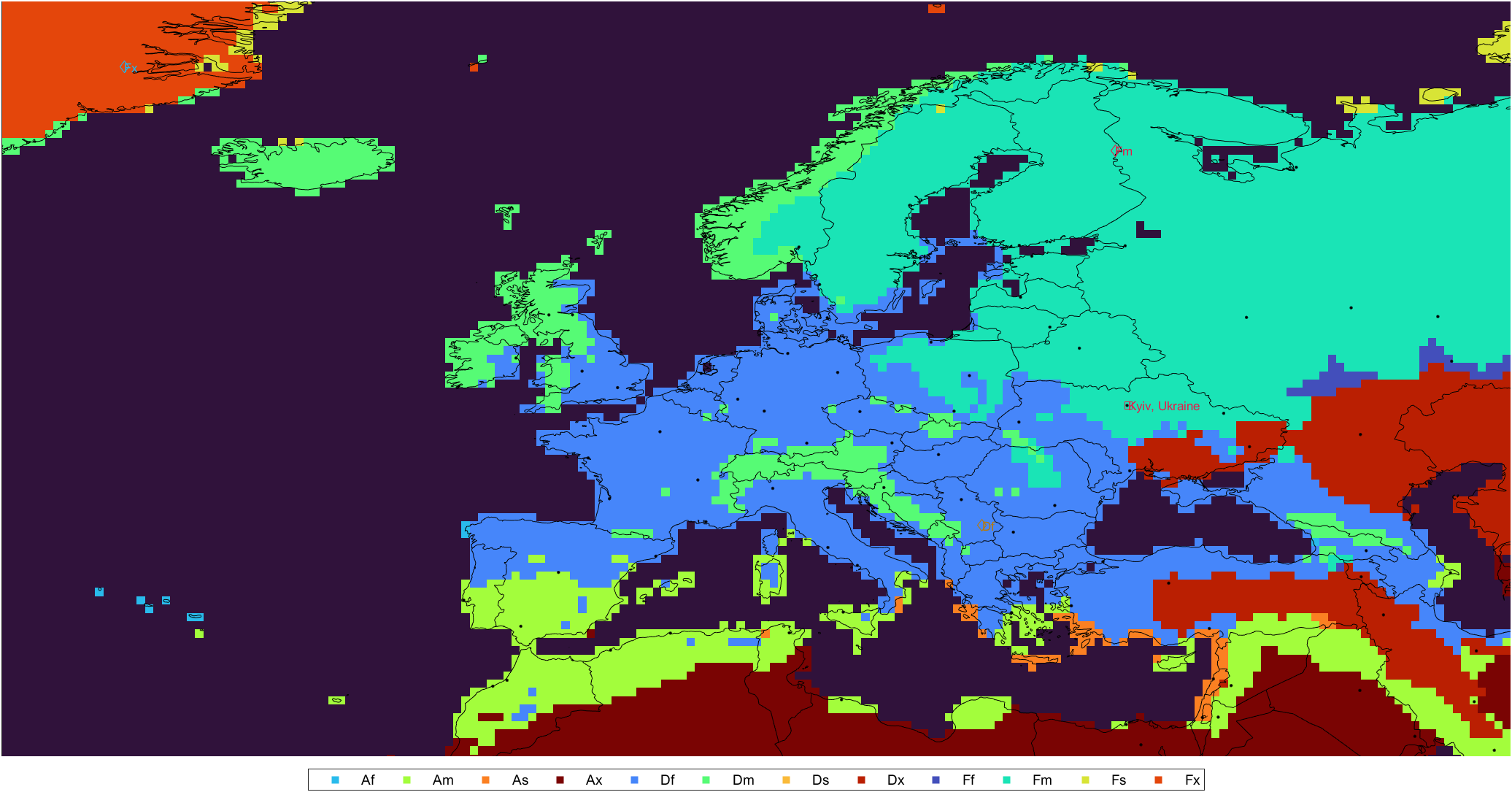 Climate map of Europe, 1911-1940 normals. Right-click for full image.
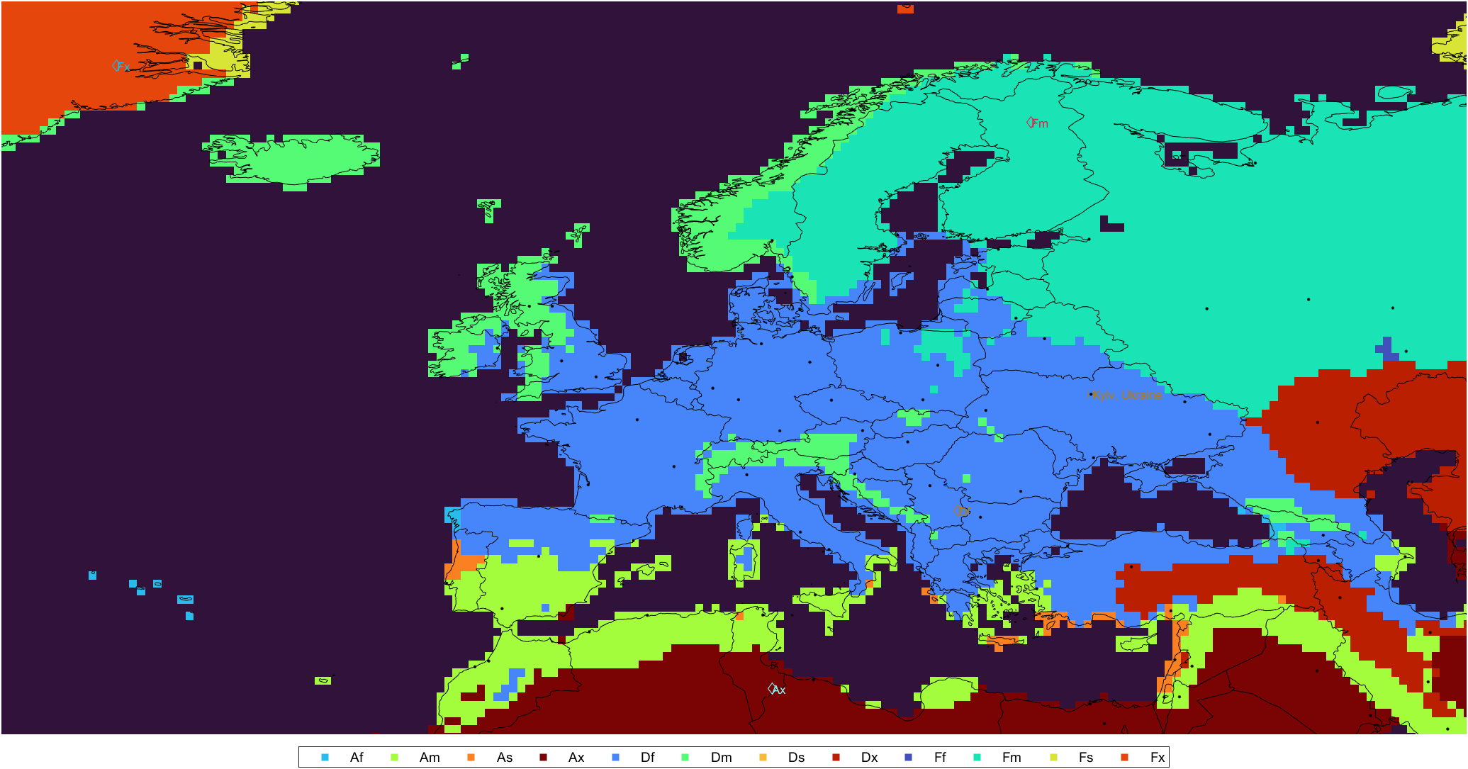 Climate map of Europe, 1991-2020 normals. Right-click for full image.
- The boundary between the humid continental Fm and the temperate Df significantly retreats inland. The majority of Poland, Ukraine, Lithuania and southwestern half of Belarus have transitioned into a temperate climate.
- The oceanic climate Dm along the Alps shrinks due to the temperature rise in the foothills.
- As has emerged in central Portugal. The warming temperature prolongs the dry season.
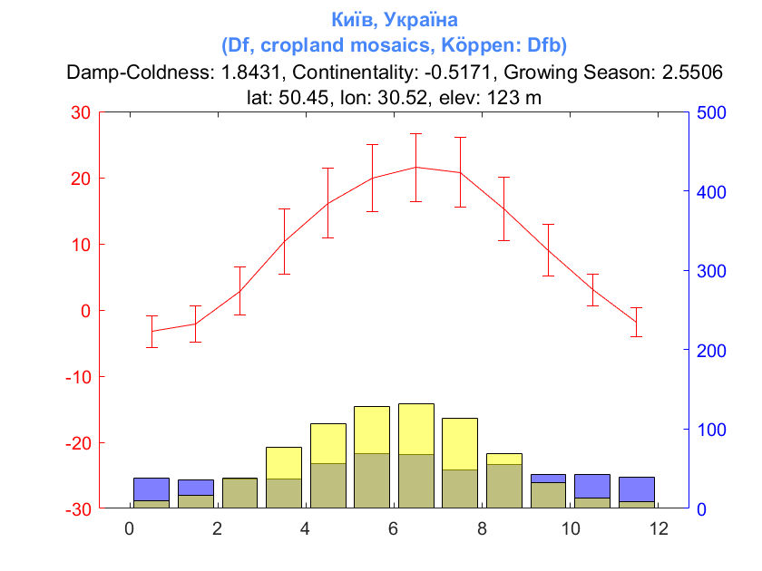
 Climate chart of Kyiv, Ukraine, 1911-1940 normals.
On the climate charts for 1911-1940 period, the dominant land cover type is not shown due to lack of data. Our land cover dataset starts from 2001.
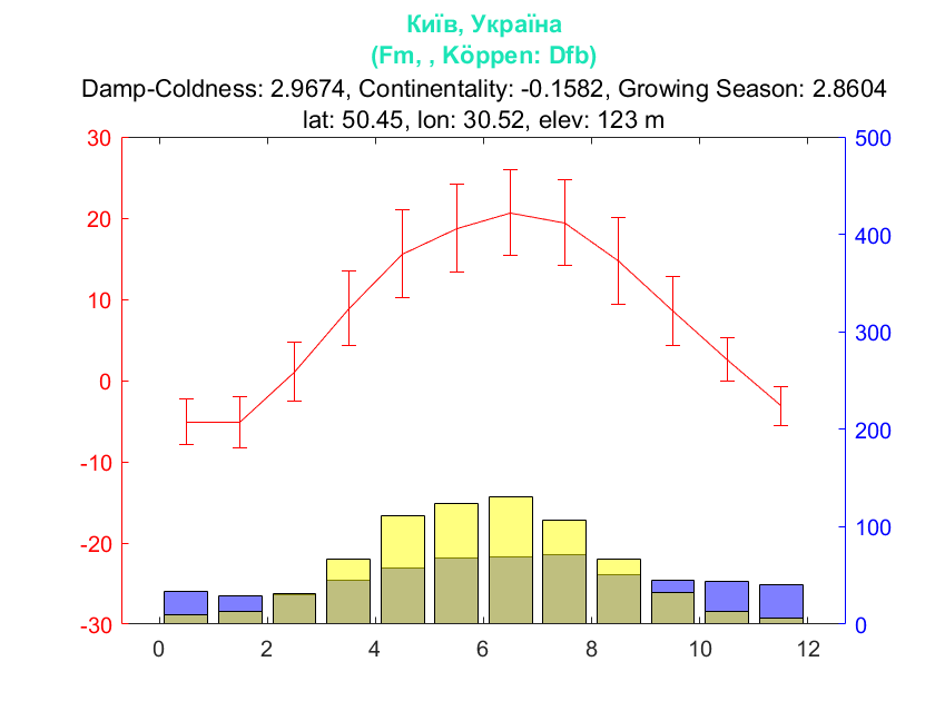
 Climate chart of Kyiv, Ukraine, 1991-2020 normals.
Kyiv’s type transition mainly attributes to the significant warming in winter. The winter average is getting close to 0°C. Also the precipitation is slightly less concentrated in summer. Both signal for a lowering continentality.
US & Canada
 Climate map of US & Canada, 1911-1940 normals. Right-click for full image.
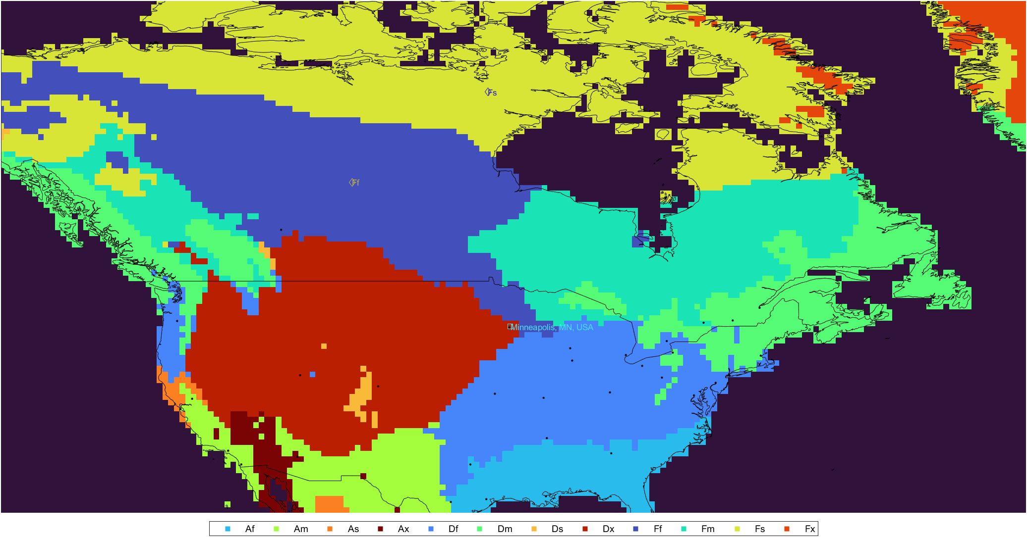
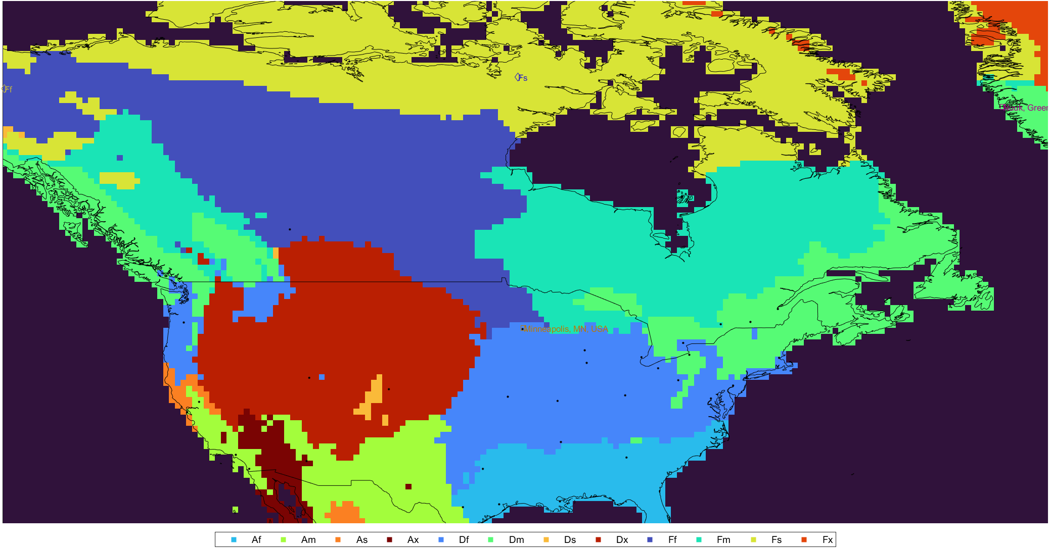 Climate map of US & Canada, 1991-2020 normals. Right-click for full image.
- The dry continental Dx retreats. The intersection of Ff, Dx and Df in the Midwest US moves westward.
- The warm types Af/Am extend northward.
- The humid types Df/Dm/Fm expand inland.
- Continental/subarctic types Fm/Ff reach northward and arctic Fs retreats.
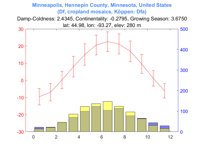
 Climate chart of Minneapolis, MN, USA, 1911-1940 normals.
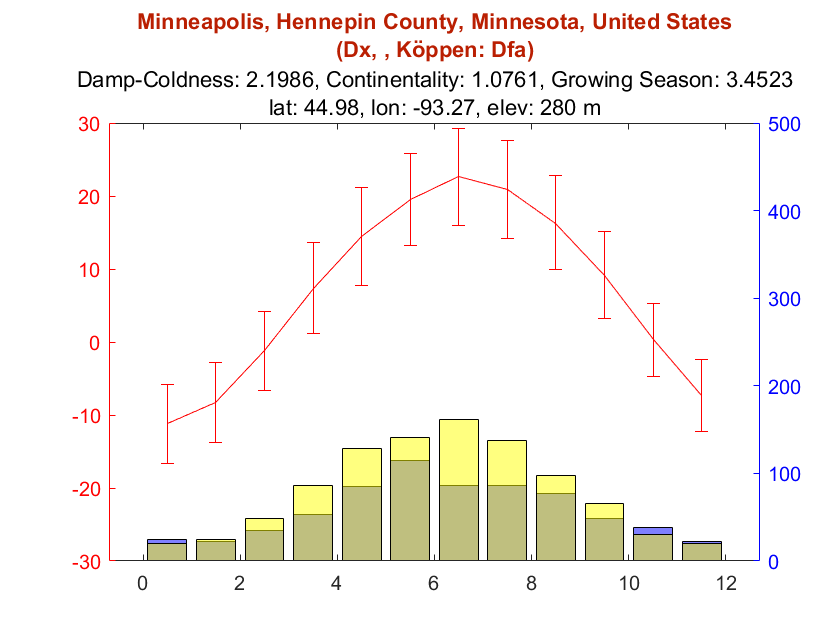
 Climate chart of Minneapolis, MN, USA, 1991-2020 normals.
Minneapolis sits at the confluence of Ff, Dx and Df. By 1911-1940 climate normals, it favors a classification of Dx. Eighty years later, due to more precipitation and warmer temperatures in all months other than July, it has departed from Dx and favors Df (still bordering on Ff).
North China
 Climate map of North China, 1911-1940 normals. Right-click for full image.
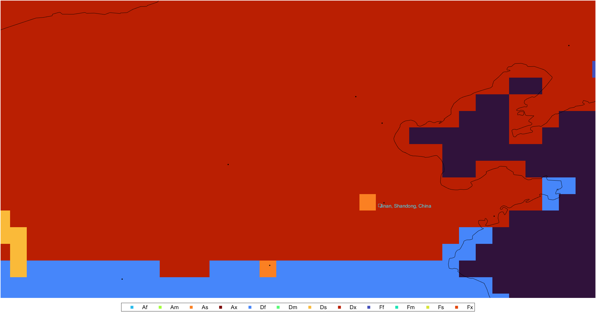
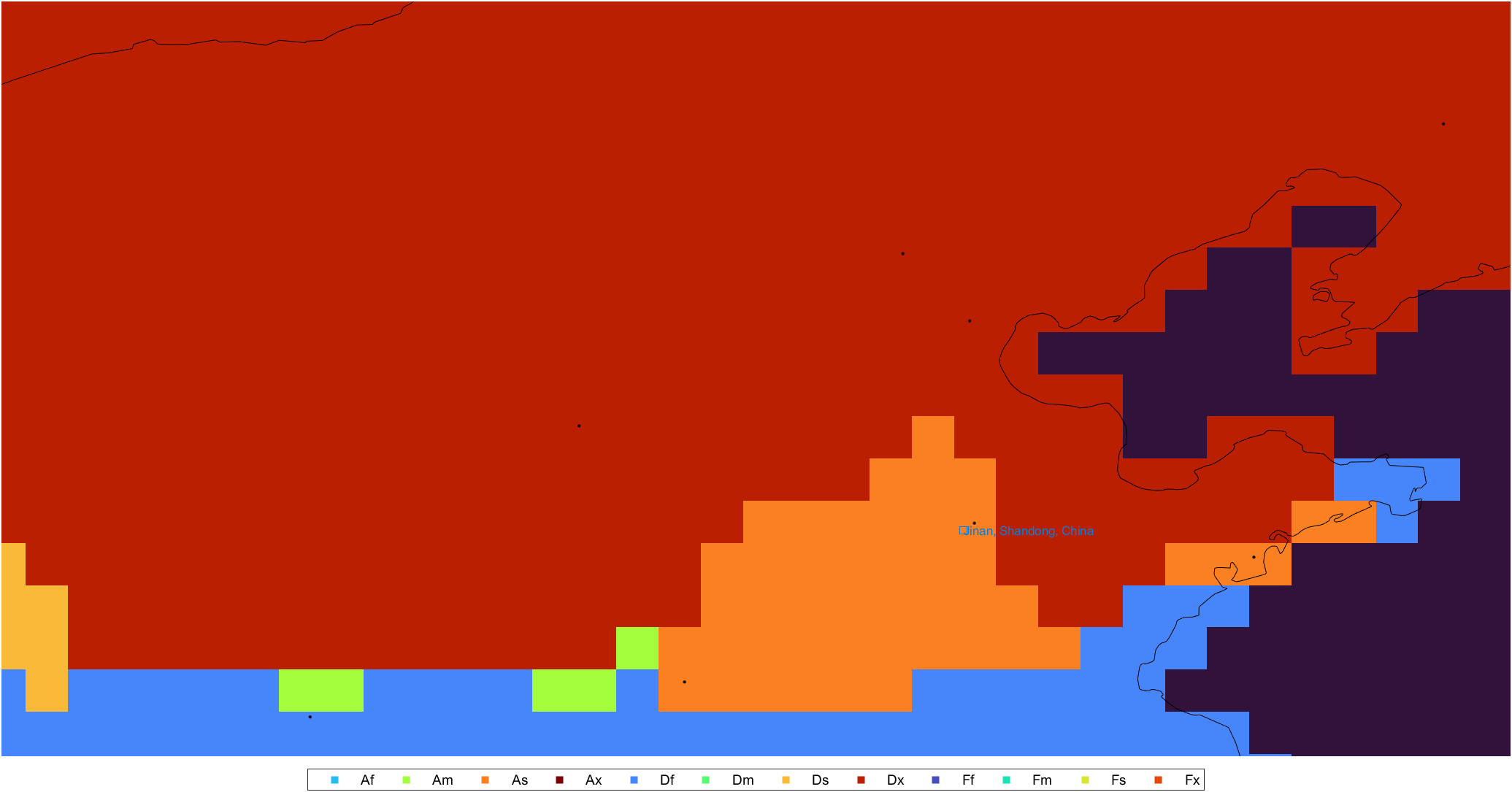 Climate map of North China, 1991-2020 normals. Right-click for full image.
- A large dry and warm area of As/Am has emerged over the original Dx.
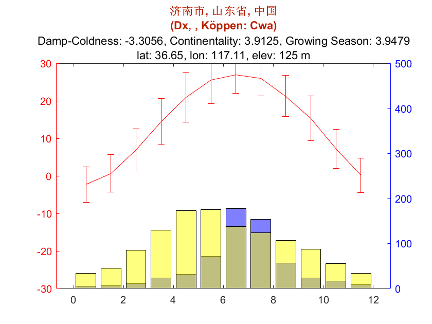 Climate chart of Jinan, Shandong, China, 1911-1940 normals.
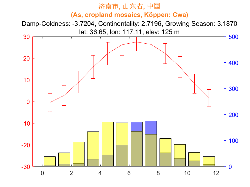 Climate chart of Jinan, Shandong, China, 1991-2020 normals.
According to traditional knowledge the North China Plain was dominated by a monsoon-influenced warm continental climate, as shown in the 1911-1940 map. However, a large area has approached or crossed the 0°C threshold of winter temperature, accounting for the type transition. The region now suffers from droughts in the dryer and warmer spring, heat waves in early summer and floods due to more sudden and intense monsoon rain.
Greenland
 Climate map of Greenland, 1911-1940 normals. Right-click for full image.
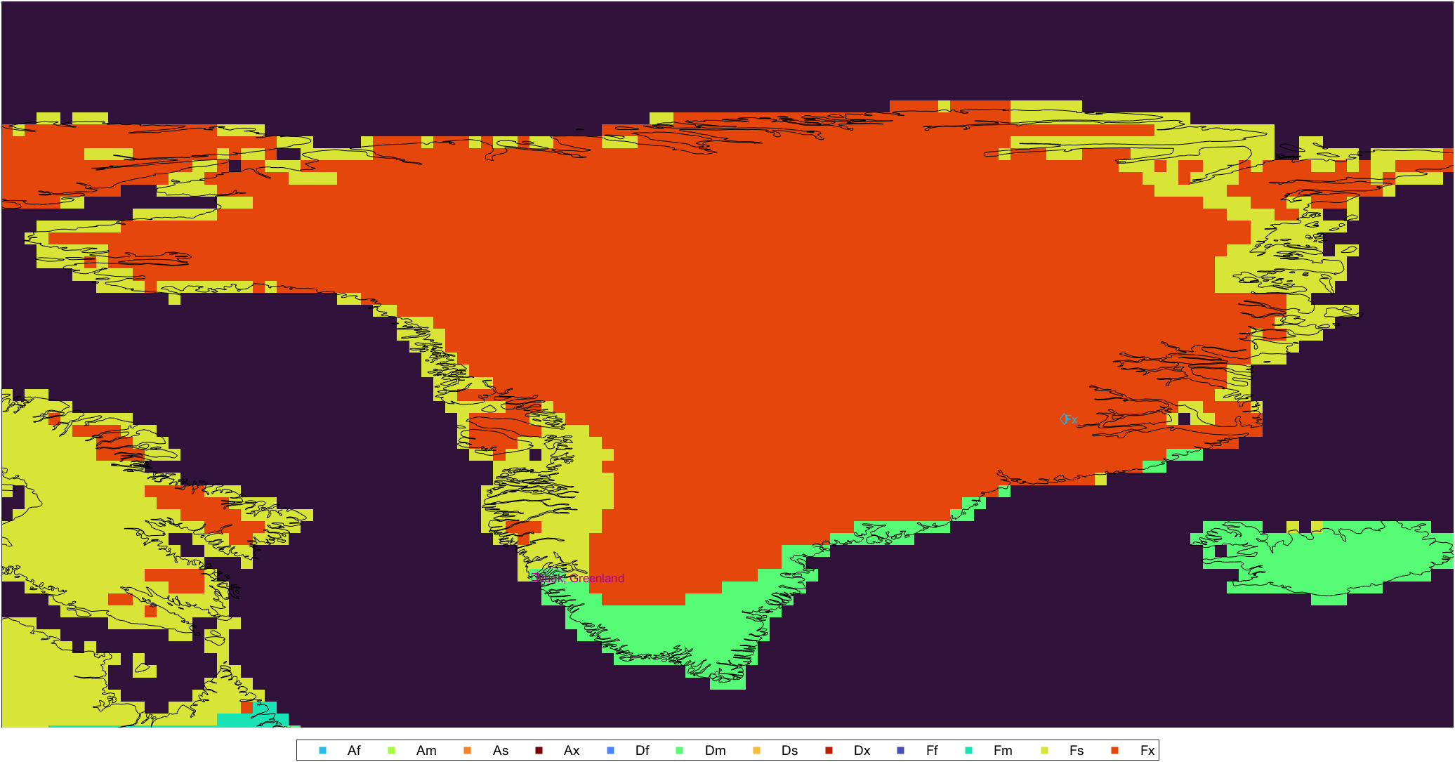
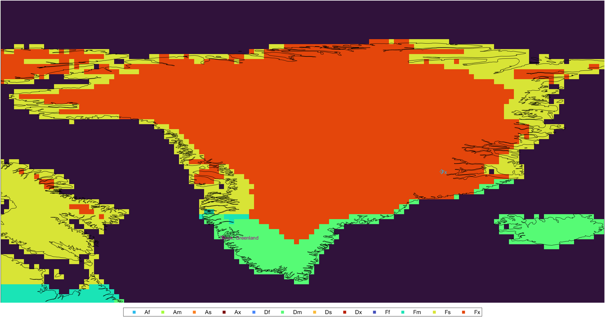 Climate map of Greenland, 1991-2020 normals. Right-click for full image.
- Oceanic Dm marches inland from south and Fs marches from east, eroding the original Fx. This suggests the melting of Greenland icecap.
- With the Fs temperature scheme largely unchanged, Fm has emerged on southwest due to the exponential increase in the evenly-spreaded annual precipitation.
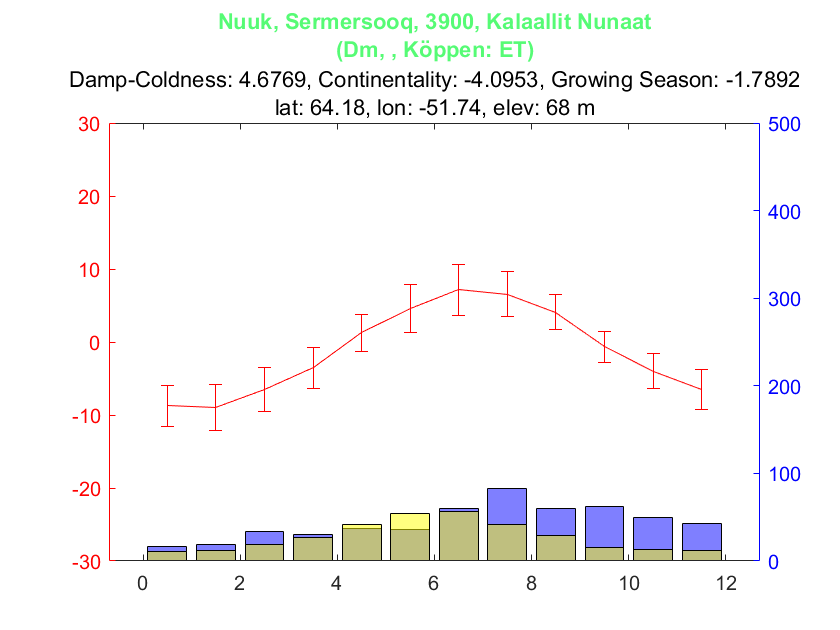 Climate chart of Nuuk, Greenland, 1911-1940 normals.
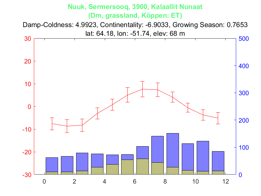 Climate chart of Nuuk, Greenland, 1991-2020 normals.
By 1911-1940 climate normals Nuuk was located on the borderline between Fs and Dm. Now it completely qualifies as Dm because of the more than doubled precipitation. Also a slight temperature rise in summer and winter is observed.
Conclusion
In this section, the climate features and the 322 scheme show their usefulness for analyzing climate change on global land. Rather than focusing on temperature and precipitation, the derived damp-coldness, continentality and seasonality features are more comprehensive and expressive for global climate. The 322 scheme, clearly defined on a SOM grid, is easy to understand and interpret. The 533-5.2 scheme which will be introduced later, though with more climatic details, is not as useful as the simple 322 scheme for this task.
Approximate methods may be developed to estimate the feature values for a longer history to enable an analysis with more certainty. Aside from the widely acknowledged accelerating warming, the worrying trend of a simultaneous increasing in continentality and seasonality of global climate is unveiled, which is going to cause more extreme climate disasters if humans don’t take immediate action to take it down.
tags: